
Anúncios
Measuring land has never been easier. With just your smartphone, you can now calculate property dimensions, estimate areas, and plan projects without needing expensive equipment or professional surveyors.
Smart Tools for Land Measurement
Explore GPS Technology
Gone are the days when measuring land required complex instruments, tape measures stretching across vast distances, or hiring costly professionals. Today’s smartphones pack incredible technology that turns your pocket device into a sophisticated surveying tool.
Anúncios
Whether you’re a homeowner planning a garden, a real estate investor evaluating property, or a contractor preparing for construction, mobile measurement apps offer convenient solutions. These applications leverage GPS, augmented reality, and advanced sensors to deliver surprisingly accurate results that rival traditional methods.
📱 How Smartphone Land Measurement Actually Works
The technology behind mobile land measurement combines several smartphone features working in harmony. Your device’s GPS receiver determines geographical coordinates with impressive precision, while accelerometers and gyroscopes track movement and orientation. Modern apps use this sensor fusion to calculate distances as you walk property boundaries.
Anúncios
Advanced applications incorporate augmented reality overlays, displaying real-time measurements on your camera view. This visual feedback makes the measurement process intuitive and helps you verify accuracy on the spot. The computational power of today’s smartphones processes this data instantly, converting raw sensor information into meaningful measurements.
Satellite positioning systems have evolved dramatically over recent years. Where older GPS technology offered accuracy within 10-15 feet, current systems utilizing multiple satellite networks can achieve precision within 3-6 feet for consumer devices. Professional-grade apps using differential GPS techniques can narrow this margin even further.
🛰️ Understanding GPS Accuracy Limitations
While smartphone measurement technology impresses, understanding its limitations ensures realistic expectations. GPS signals can be affected by atmospheric conditions, tall buildings, dense tree cover, and even solar activity. Urban canyons created by skyscrapers may cause signal reflection, introducing measurement errors.
The quality of your device’s GPS chip significantly impacts results. Flagship smartphones typically feature superior GPS receivers compared to budget models, offering faster satellite acquisition and better signal processing. Some apps compensate for hardware differences through sophisticated algorithms that filter out erratic readings.
🏆 Top Apps for Measuring Land with Your Phone
The app marketplace offers numerous land measurement solutions, each with distinct features and capabilities. GPS Fields Area Measure stands among the most popular choices, providing straightforward area calculation by walking or driving property perimeters. The interface displays your path in real-time, calculating acreage automatically.
LandGlide combines measurement tools with property information databases, overlaying parcel boundaries on satellite imagery. This dual functionality helps verify your measurements against official property lines while accessing ownership records and tax information. The subscription-based model provides county-level data across the United States.
Measure Map Pro offers versatility beyond simple area calculation. Users can measure distances, perimeters, and even elevation changes. The app supports multiple measurement units and allows exporting data for professional reports. Its offline mapping capability proves invaluable when measuring remote properties without cellular coverage.
🌟 Specialized Applications for Professionals
Construction and surveying professionals often require enhanced accuracy and documentation features. Magnet Field Layout connects to external GPS receivers, achieving centimeter-level precision for stake-out and verification work. The app integrates with CAD files, enabling field crews to implement design plans accurately.
Planimeter provides comprehensive toolkit functionality within a single application. Beyond basic area measurement, it calculates volumes for earthwork estimation, supports coordinate system conversions, and generates detailed reports with photos and annotations. The learning curve rewards users with professional-grade capabilities.
📏 Step-by-Step Guide to Measuring Your Property
Successful land measurement begins with preparation. Ensure your smartphone battery is fully charged, as GPS usage drains power quickly. Download offline maps if measuring in areas with poor cellular reception. Clear any phone case that might interfere with GPS reception, particularly metal or thick rubber cases.
Launch your chosen measurement app and wait for GPS accuracy indicators to stabilize. Most quality apps display current accuracy levels—wait until achieving the best available precision before starting measurements. This patience upfront prevents inaccurate data that would require remeasurement.
Begin at a clearly identifiable corner or boundary marker. Mark this starting point in the app, then walk steadily along the property boundary, keeping your phone stable and avoiding sudden movements. The app records your path as a series of GPS coordinates, creating a digital representation of the boundary.
✅ Pro Tips for Maximum Accuracy
Walking the perimeter multiple times and averaging results significantly improves accuracy. Measurement errors tend to be random rather than systematic, so repeated measurements smooth out GPS fluctuations. Professional surveyors using consumer-grade apps often employ this technique for enhanced reliability.
Measure during optimal conditions when possible. Mid-morning or mid-afternoon provides better GPS accuracy than early morning or evening when atmospheric conditions can affect satellite signals. Avoid measuring during storms or heavy cloud cover, which may degrade GPS performance.
Hold your phone consistently throughout the measurement process. Waist level with the screen facing upward generally provides optimal GPS reception. Avoid switching between pocket and hand, as this introduces height variations that affect measurement consistency.
🎯 Practical Applications Beyond Simple Measurement
Property measurement serves as foundation for numerous practical applications. Homeowners planning irrigation systems need accurate lawn dimensions to calculate water requirements and sprinkler coverage. These calculations directly impact system efficiency and water bills, making precision important beyond simple curiosity.
Fencing projects require detailed perimeter measurements for material estimation. Knowing exact linear footage prevents both material shortages mid-project and costly over-ordering. Add gate locations and terrain variations to your measurements for comprehensive planning.
Agricultural applications extend from hobby gardens to commercial farming. Crop rotation planning, fertilizer application rates, and yield predictions all depend on accurate field measurements. Small farm operators particularly benefit from free or low-cost measurement apps versus expensive surveying services.
🏡 Real Estate and Property Transactions
Buyers and sellers increasingly use smartphone measurements to verify property descriptions before transactions. Discrepancies between listed acreage and actual measurements can significantly impact property value and negotiations. Quick mobile verification provides confidence without survey expenses.
Property line disputes with neighbors often begin with unclear boundaries. While smartphone measurements won’t replace official surveys for legal purposes, they provide preliminary data to assess whether professional surveying investment is warranted. Sometimes measurements confirm boundaries are exactly where everyone assumes.
🔧 Enhancing Accuracy with Additional Tools
External GPS receivers dramatically improve smartphone measurement accuracy. Bluetooth GPS units starting around $100 achieve sub-meter precision, while professional-grade receivers reach centimeter accuracy. These devices pair seamlessly with measurement apps, leveraging your phone’s computing power while using superior GPS hardware.
Survey rods or range poles help maintain consistent measurement height when walking boundaries. Simple wooden stakes work equally well for marking corners and reference points. Physical markers ensure you’re measuring the same boundary repeatedly and provide visual verification of your path.
Portable battery packs extend measurement sessions beyond your phone’s battery capacity. GPS activities consume significant power, and large property measurements may require hours. A 10,000mAh power bank typically provides full-day measurement capability without power concerns.
📊 Calibration and Verification Techniques
Regular calibration maintains measurement accuracy over time. Test your setup against known distances—measure your driveway, house perimeter, or local sports field with documented dimensions. Compare app results against these reference measurements to understand your system’s accuracy profile.
Cross-referencing measurements using multiple apps identifies outliers and confirms consistency. When two independent apps using different algorithms produce similar results, confidence in accuracy increases substantially. Significant discrepancies suggest GPS issues requiring troubleshooting.
💡 Common Mistakes and How to Avoid Them
Walking too quickly represents the most frequent error in mobile land measurement. Rushing causes irregular GPS point spacing and increases the likelihood of recording inaccurate positions. Maintain a steady, moderate pace allowing the app to capture clean, evenly-spaced data points.
Ignoring GPS accuracy indicators leads to poor measurements. When your app displays accuracy exceeding 20 feet, pause and wait for improvement before continuing. Including highly inaccurate points in your measurement introduces errors that persist through the entire calculation.
Forgetting to close the measurement loop creates uncalculated areas. Most area measurement apps require returning to your starting point to complete the polygon. Leaving gaps between start and end points forces the app to estimate closure, reducing overall accuracy.
🚫 Environmental Factors to Watch
Dense tree canopy significantly degrades GPS accuracy by blocking satellite signals. When measuring wooded properties, stick to clearings and edge boundaries where possible. If measuring under trees is unavoidable, expect reduced accuracy and consider multiple measurement passes.
Steep terrain introduces additional complexity to area calculations. Simple GPS measurements capture horizontal distance but may underestimate actual surface area on slopes. Advanced apps include slope correction features—enable these settings when measuring hillsides to account for terrain variations.
🌐 Comparing Mobile Measurements to Professional Surveys
Professional land surveys using total stations and differential GPS achieve accuracy within inches, far exceeding smartphone capabilities. These surveys provide legally defensible boundaries for property transactions, construction projects, and dispute resolution. Mobile measurements serve different purposes with appropriate accuracy tradeoffs.
Cost differences are substantial. Professional surveys typically range from several hundred to several thousand dollars depending on property size and complexity. Smartphone measurement apps cost nothing to $50 annually, making them accessible for preliminary assessments and informal measurements.
Understanding when professional surveying is necessary versus when mobile measurement suffices saves both money and time. Property purchases, construction projects, and legal boundaries require professional surveys. Garden planning, rough estimates, and personal property management work perfectly with smartphone tools.
🔮 Future Technology Trends in Mobile Measurement
Augmented reality integration continues advancing, with newer apps overlaying measurement data, property lines, and even proposed structures onto live camera views. This visualization helps property owners conceptualize projects before committing resources, bridging the gap between imagination and reality.
Artificial intelligence algorithms are improving GPS accuracy through sophisticated error correction. Machine learning models identify and compensate for common GPS errors, effectively squeezing better performance from existing hardware. This software-based accuracy enhancement benefits all users without requiring new devices.
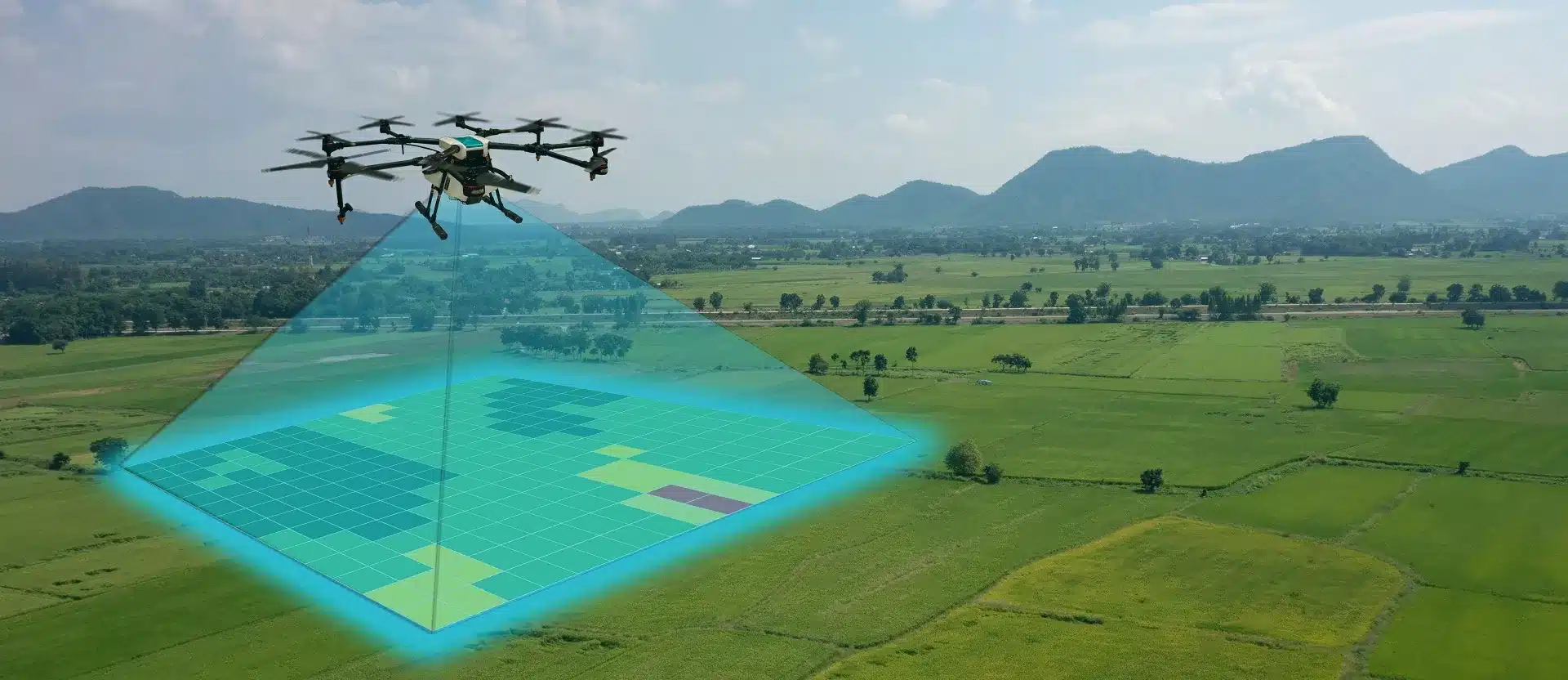
Drone integration represents an exciting frontier for property measurement. Apps controlling camera drones can photograph properties from above, using photogrammetry to calculate areas and create 3D models. This aerial perspective combined with GPS ground truth provides comprehensive property documentation.
📝 Documentation and Record Keeping
Saving measurements creates valuable property records. Most apps export data in various formats including PDF reports, KML files for Google Earth, and CAD-compatible formats. Maintaining these records documents property conditions over time and provides reference for future projects.
Adding photos and notes to measurements enhances their usefulness. Annotate boundary markers, notable features, and measurement conditions. Future reference to these details provides context that raw numbers alone cannot convey, particularly when revisiting measurements months or years later.
Cloud backup ensures measurement data survives phone upgrades, losses, or failures. Many professional-grade apps include automatic cloud synchronization. For apps lacking this feature, manually export and store measurement files in cloud storage services for long-term preservation.
🎓 Learning Resources and Community Support
Online communities provide valuable support for mobile measurement users. Forums and social media groups share tips, troubleshoot problems, and compare app experiences. These communities often discover undocumented features and optimal techniques through collective experimentation.
Video tutorials demonstrate proper measurement techniques more effectively than written instructions alone. YouTube hosts numerous walkthrough videos for popular measurement apps, showing real-world usage scenarios. Watching experienced users reveals nuances that transform measurement accuracy.
App developer resources including user manuals and FAQ sections answer common questions specific to each application. Taking time to review official documentation prevents many rookie mistakes and unlocks advanced features that casual exploration might miss.
✨ Making the Most of Your Mobile Measurement Tools
Smartphone land measurement technology democratizes property information that was once exclusive to professionals with expensive equipment. While not replacing legal surveys for critical applications, these tools empower property owners with knowledge previously requiring significant investment.
Success comes from understanding both capabilities and limitations. Use mobile measurements for appropriate applications while recognizing when professional surveying becomes necessary. This balanced approach maximizes value from smartphone technology while ensuring critical accuracy when situations demand it.
Start with simple measurements to build confidence and technique. Measure familiar properties with known dimensions before tackling important projects. This practice develops intuition for GPS accuracy, optimal measurement techniques, and your chosen app’s quirks and capabilities.
The combination of improving technology, falling costs, and growing app sophistication means mobile land measurement will only become more capable and accessible. Early adopters gain experience with tools that will become increasingly essential for property owners, contractors, and real estate professionals alike.